
Skip to content

Environmental & Climate

Atmosphere/ocean circulation, pollution dispersion, ecosystem dynamics

19 articles

Article

LISFLOOD-FP: High-Performance Raster-Based 2D Flood Inundation Modeling at Continental Scale

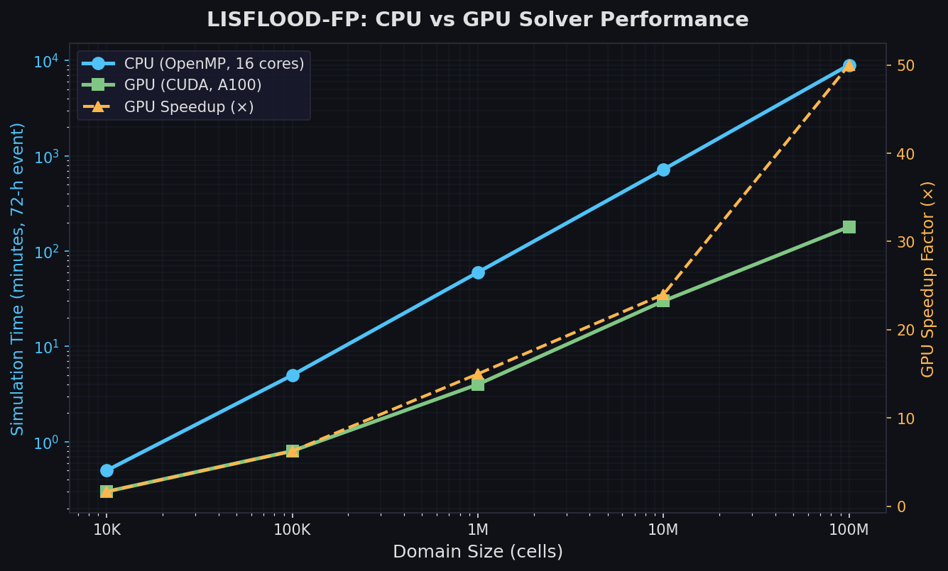
LISFLOOD-FP is an open-source, raster-based 2D hydraulic model that uses a local inertial approximation of the shallow-water equations to simulate flood inundation at scales ranging from individual river reaches to entire continents. Its GPU-accelerated solver, subgrid channel model, and GLUE-based calibration framework make it the tool of choice for large-scale flood hazard mapping and real-time forecasting.

By Jeff 71 views
Article

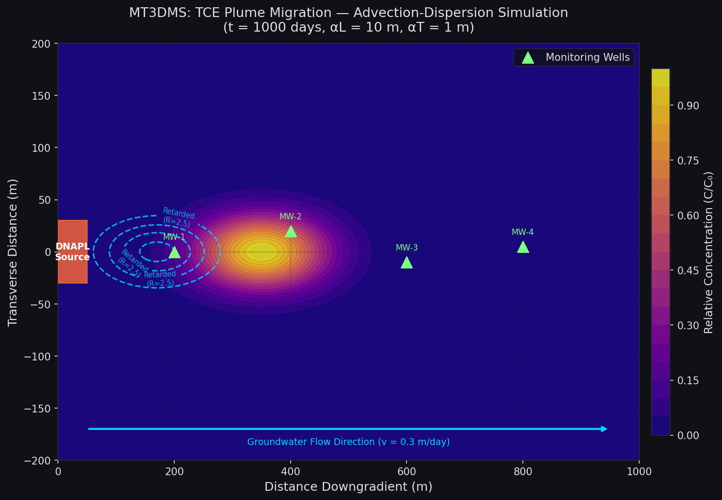
MT3DMS: Simulating Groundwater Contaminant Transport with Multi-Species Reactive Solute Modeling

MT3DMS is the industry-standard modular transport simulator for quantifying dissolved contaminant migration, dispersion, and reaction in saturated aquifer systems. Coupled with MODFLOW, it solves the advection-dispersion-reaction equation for multiple species including chlorinated solvents undergoing sequential reductive dechlorination. This guide covers solver selection, sorption and biodegradation configuration, DNAPL source zone characterization, and density-dependent transport with SEAWAT.

By Jeff 121 views
Article

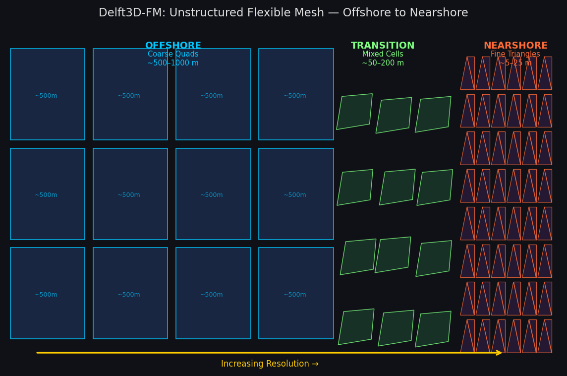
Delft3D-FM: Flexible-Mesh Hydrodynamic Simulation for Coastal, Estuarine, and River Systems

Delft3D-FM's unstructured mesh engine enables high-fidelity coastal and estuarine hydrodynamic simulation by combining flexible mesh resolution with tightly coupled wave, sediment transport, and water quality modules. This article covers the D-Flow FM solver architecture, module coupling strategy, and a practical storm-surge inundation workflow. It also highlights the growing Python ecosystem—hydrolib-core, meshkernel, and dfm_tools—that supports reproducible, script-driven modeling pipelines.

By Jeff 154 views
Article

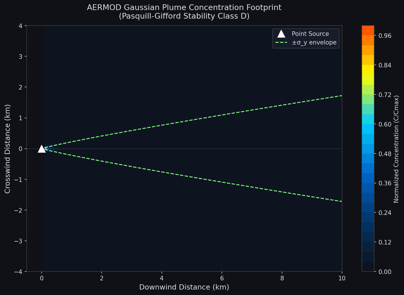
AERMOD: Regulatory Air Dispersion Modeling for Industrial Source Impact Assessment

AERMOD is the EPA's preferred Gaussian plume dispersion model for near-field air quality analysis. This article covers the AERMET meteorological pre-processor, AERMAP terrain handling, and the PRIME building downwash algorithm—the three components most critical to producing defensible regulatory permit analyses.

By Jeff 152 views
Article

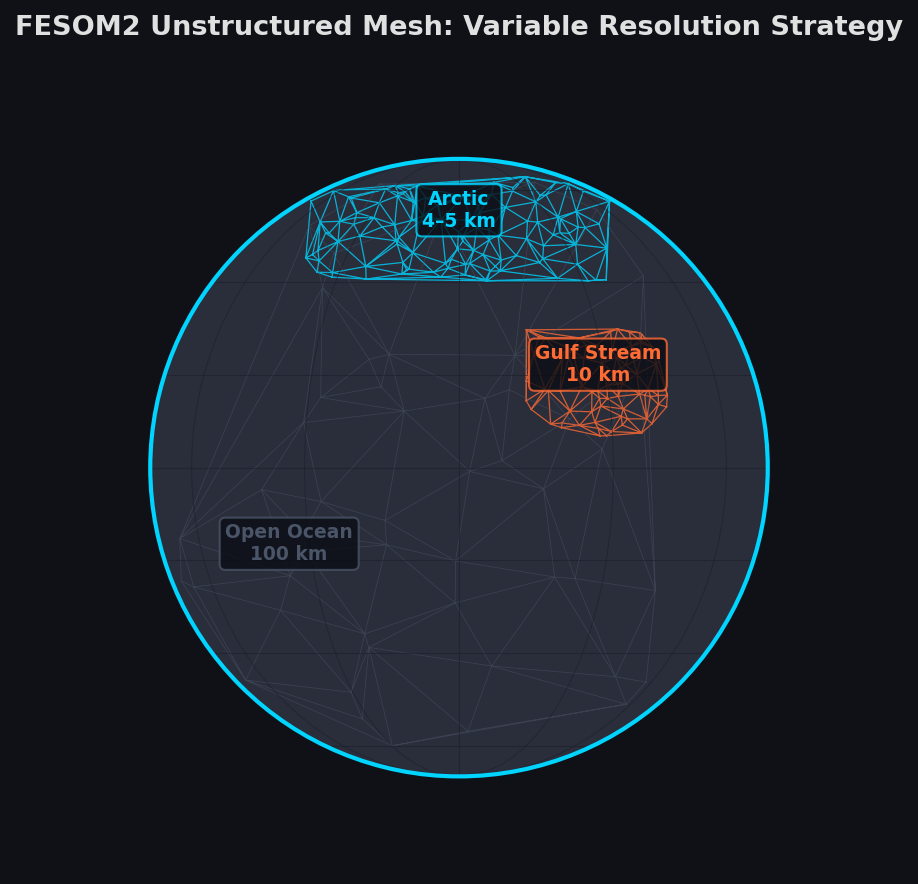
FESOM2: Unstructured-Mesh Ocean–Sea-Ice Simulation for Multi-Scale Climate Modeling

FESOM2 is an open-source finite-volume ocean–sea-ice model that uses an unstructured triangular mesh to achieve variable resolution across the global ocean. It enables simultaneous high-resolution simulation of the Arctic, boundary currents, and ice-shelf cavities within a single globally consistent framework, forming the ocean component of the AWI-CM CMIP6 model.

By Jeff 134 views
Article

MODFLOW 6: Advanced Groundwater Flow Simulation with the Modular Hydrologic Model Framework

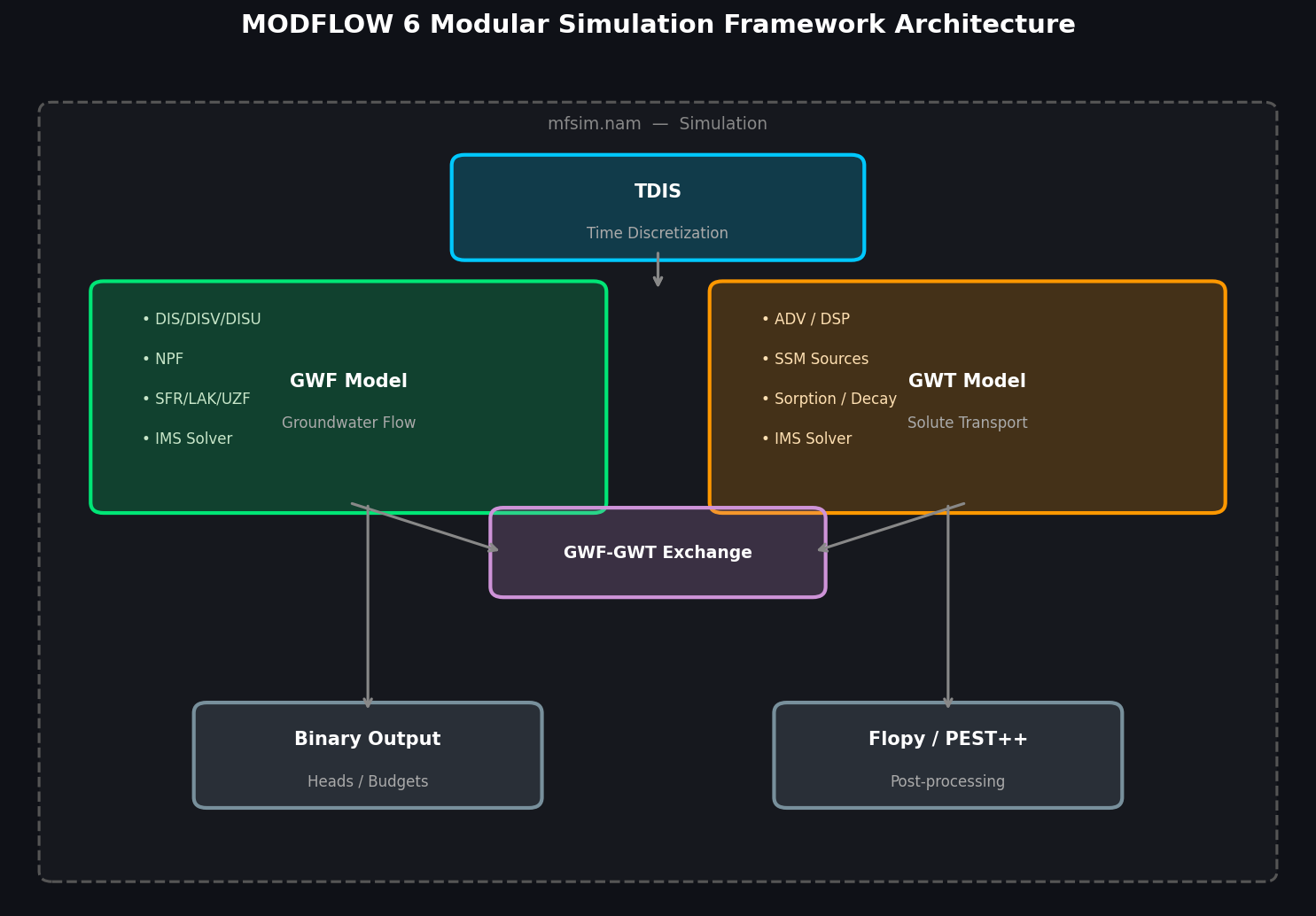
MODFLOW 6 is the USGS flagship groundwater modeling platform, featuring a modular simulation framework, unstructured grid support, and Newton-Raphson linearization for robust unconfined aquifer simulation. This article covers its key capabilities including multi-model coupling, integrated surface-water/groundwater interaction, solute transport, and Python-based workflows with Flopy and PEST++.

By Jeff 200 views
Article

EPA SWMM 5.2: Simulating Green Infrastructure Performance for Urban Stormwater Management

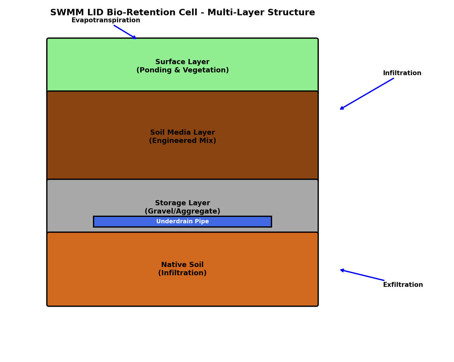
EPA SWMM 5.2's Low Impact Development module provides physically based simulation of bioretention cells, permeable pavements, green roofs, and other nature-based stormwater controls. This article covers LID layer parameterization, continuous simulation best practices, water quality modeling, and integration with downstream tools for urban drainage design.

By Jeff 415 views
Article

MIKE FLOOD: Mastering 1D–2D Coupled Flood Simulation for Urban and Coastal Inundation Modeling

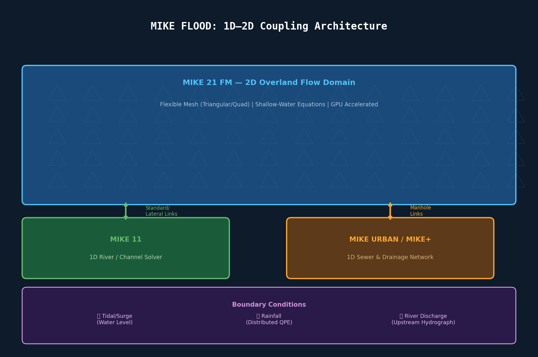
MIKE FLOOD by DHI tightly couples 1D river/drainage solvers (MIKE 11, MIKE URBAN) with a 2D overland flow engine (MIKE 21) to simulate urban and coastal inundation with bidirectional hydraulic exchange. This article covers link type selection, flexible mesh design for urban domains, compound flood boundary condition synchronization, GPU acceleration, and validation best practices using CSI and NSE metrics.

By Jeff 528 views
Article

MOHID Water Modelling System: Integrated Coastal and Estuarine Simulation for Water Quality Assessment

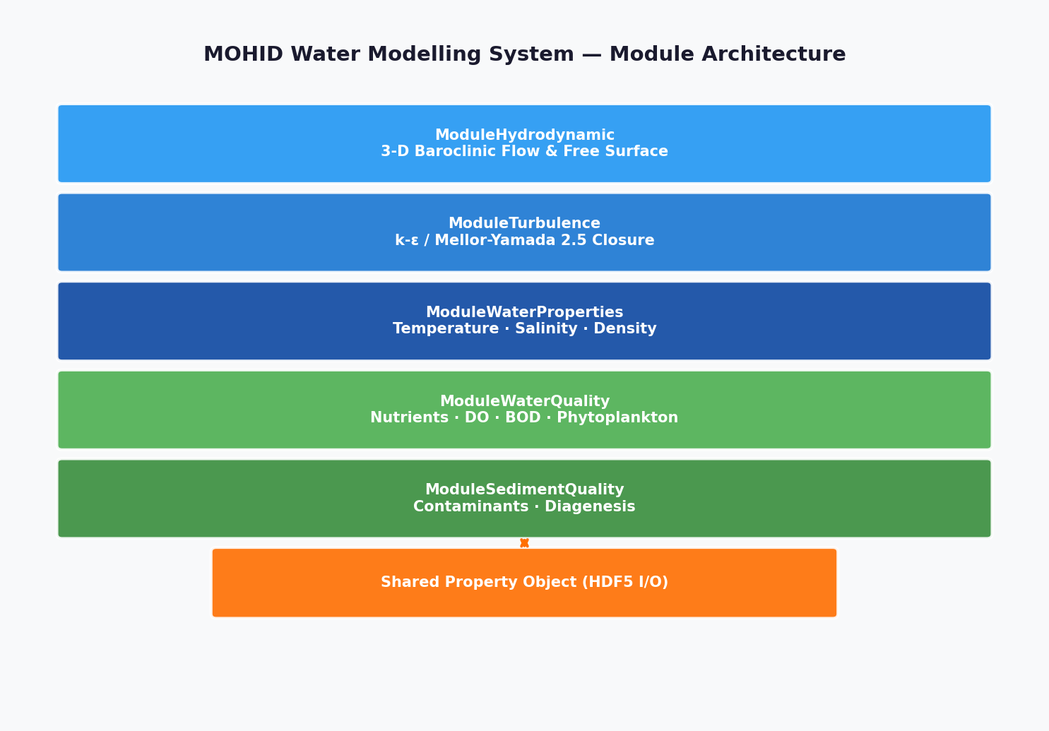
MOHID is an open-source, three-dimensional water modelling system that tightly couples hydrodynamics, turbulence, sediment transport, and water quality modules within a single framework. This article covers MOHID's water quality module configuration, key biogeochemical kinetics parameterizations, MPI parallelization strategies, and a rigorous validation workflow for estuarine and coastal applications. Practical guidance is provided for practitioners transitioning from EFDC or Delft3D-WAQ.

By Jeff 323 views
Article

TELEMAC-2D: Depth-Averaged Hydrodynamic Simulation for Coastal and Riverine Flood Modeling

TELEMAC-2D is a finite-element shallow-water solver that uses unstructured triangular meshes to simulate free-surface flows in rivers, estuaries, and coastal zones with high spatial adaptability. This article covers its governing equations, mesh generation best practices, turbulence closure options, boundary condition setup for storm surge modeling, and validation workflows for operational flood forecasting.

By Jeff 389 views
Article

ROMS: Sediment Transport and Biogeochemical Coupling in Regional Ocean Modeling

The Regional Ocean Modeling System (ROMS) offers tightly integrated sediment transport (CSTMS) and biogeochemical (Fennel BGC) modules that enable two-way coupled coastal ocean simulations. This article examines how to configure and run ROMS with coupled sediment–BGC physics to simulate turbidity-driven light limitation, eutrophication, and seasonal hypoxia. Practical guidance covers input file setup, CPP flag selection, MPI parallelization, and validation against satellite and in-situ observations.

By Jeff 308 views